Saturday, August 29, 2015

Making Delhi A Smart City

Imagine driving in Delhi without getting trapped in traffic, being able to drift around freely, knowing where to park and hopping on the public transport without losing time, energy and patience.

Let us see where we are and where we have to go!!

Challenges:
Metropolitan Cities like Delhi, are the places where 50% of the world’s population live today, Responsible for 75% of its energy consumption and 80% of its carbon emissions - and cities are growing. Cities face huge challenges: congestion, pollution, blackouts, crime, debt and rising costs - while competing with each other for investment, jobs and talents.

Cities need to become smarter: more efficient, sustainable and liveable.

5 Basic steps to make a city smart:
1. Vision: setting the goal and the roadmap to get there
2. Solutions: bringing in the technology to improve the efficiency of the urban systems
3. Integration: combining information and operations for overall city efficiency
4. Innovation: building each city’s specific business model
5. Collaboration: driving collaboration between global players and local stakeholders

As cities grow and expand, so will urban transportation systems - increasing traffic congestion, threatening safety, wasting commuter time and valuable fuel, and impacting the environment. Cities are where traffic flows – cars, buses, subways and trains epitomise city life.

Cities need to make mobility smarter: more efficient, reliable and green. green. Urban populations will nearly double by 2050 accounting for 70 percent of the world’s population. Undoubtedly, transportation systems will be impacted, increasing congestion, threatening safety, delaying commuters, burning up valuable fuel, and harming the environment. To meet current and anticipated challenges, Smart Cities around the world are finding Smart Mobility solutions for integrated city management—improving mobility for citizens through operational efficiency and smart information. Reduce urban traffic congestion and improve air quality through centralized, real-time adaptive traffic management.

As things stand, the urbanization agenda is: urban renewal; rejuvenation and the implementation of smart city concept; While renewal and rejuvenation are relatively easier to grasp, there appears to be only an evocative imagination in the public mind as to what the contours of a smart city could be. So, here are few suggested attributes that may well describe, and to some extent define a smart city. 

Information, communication, and technology (ICT)-enabled governance: The international and domestic big daddies of the information technology (IT) world have, with their aggressive presentations, virtually hijacked the smart city definition to only mean IT-enabled administration and governance. Often referred to as "smart government", the use of integrated technology platforms that are easily accessible across various devices is certainly key to providing access, transparency, speed, participation and redressal in public services.

Efficient utilities - energy, water, solid waste and effluents: This area is often the most talked about after IT. Smart meters, renewable energy, energy conservation, water harvesting, effluent recycling, scientific solid waste disposal methods etc.. all clearly mark the hallmark of a smart city.

Meaningful PPPs: The creative use of public-private partnerships (PPPs) is a key attribute of the smart city concept. PPPs are to be used not only as a source of much-needed capital but also for the efficient delivery of utilities with agreed service-level standards. PPPs could range from health care to street lighting; and be used wherever there is a clear connection between the provision of a service and the ability to charge for the same - directly or even indirectly.

Safety and security: This aspect is high in public consciousness, especially with disconcerting news on the safety of women, road rage, robbery attacks on the elderly and juvenile delinquency. Clearly, networks of video cameras, brightly lit public areas, intensive patrolling and surveillance, identity-verified access, and rapid response to emergency calls are all on the expectations list.

Financial sustainability: The 74th Amendment to the Constitution (1992) enjoins towns and cities to "take charge of their own destinies". Nowhere is this more important than financial independence. This is only possible with elaborate and extensive tapping of all sources of revenue - property taxes, advertisements etc. coupled with astute collection of user-pay charges across the full range of utilities.

Citizen-participative local government: The enthusiastic participation of citizens in local issues needs careful designing of electoral and participative forums. The current apathy towards civic elections needs comprehensive reversal.

Sufficient social capital: Smart cities cannot be devoid of the appropriate levels of social infrastructure - like schools, hospitals, public spaces, sporting and recreational grounds and retail and entertainment venues. Along with a brain that works, and hands and legs that move, it must also have a heart that beats to the joys of daily living.

Transit-oriented habitats: "Walk-to-work" is the dream solution here. Nevertheless, conveniently networked public transportation with first- and last-mile connectivity’s in place, reduced motivation to use personal vehicles, use of electric cars, and bicycle paths are all in the expectation matrix. 

Green features: Minimizing the carbon footprint and eco-friendliness are important. Parks and verdant open spaces, absence of pollution, use of renewables, conservation and recycling are mandatory. It has rooftop solar energy, electric cars and electric-powered bicycles.

India has 5,545 urban agglomerations. Class 1 towns (called cities) are those with a population of 100,000 and above. This should be the minimum population cut-off for a smart city. Achieving all the above-mentioned attributes may well be Utopian. So, maybe even if seventy percent of them are achieved, we should have no hesitation in declaring an urban habitation as a smart city.

Tuesday, August 25, 2015

Making a Smart City

Turning Delhi and its metropolitan area into a Smart City as a vision is beautiful but turning it into a reality would require lot of combined efforts. Making a Smart City out of a city is a complex process involving deep - rooted innovation with regard to: tangible and intangible infrastructures, the lifestyles of citizens; the regeneration and design of public spaces, strategies and tools to develop the economy and the handling of complexities. It requires a rethinking of policies and actions in order to create a community life and compete in a globalized world, also in terms of the changing rhythms of life and work in the "Smart" city. Many different players are part of this process: from large multinationals to social enterprises, from small and medium businesses to universities, from research centers to the world of associations. Public institutions, especially local ones, can play central role in facilitating, connecting and coordinating.

Public administration on its own can not transform a city into a smart city, but it does have the task of creating a favorable environment where the best and blue chip players within its area, work successfully towards common goals and shared vision. Smart city not only cultivates its technological component, but also combines: economic development and social inclusion, innovation and training, research and participation, and, at the same time, acquires all the tools necessary to provide the strategic framework, the internal coordination and the synergy, bringing together the different players.

In order to help trigger a virtuous circle, enhance existing synergies, meet the City's needs and making things practical and effective would call for active citizenship, following a public - public partnership model, building a strategy with the stakeholders and to foster a framework of governance suitable for a smart city. Pillars of Smart City are - Smart Economy, Smart Living, Smart Environment, Smart Mobility, Smart People. In parallel with the above process, an audit, comparison and analysis of 'smart' topics identifying potential promoters interested in the implementation of the smart process who could not only contribute with ideas and research, but also with funds and therefore, invest in the rebuilding of Delhi as a Smart City.
The underlying intention being the enhancement of the city, the social fabric of its neighbourhoods, so different in size and features so distinctive, it underlines that we should try and use the springboard for the development of a smart city which already exists in Digital, in consisting infrastructures and services including: a dense fiber networks optic, Wi-Fi hot spots, digital areas, and open data portals, among other things. All these have the aim of creating welcoming, resilient, flexible, changing city, and complement policies such as big data analysis, city EMF (electric and magnetic fields) structure plans, and so on. Through this existing data we can have a complete overview and understanding of how the smart processes can be put into place.

Delhi is already a hub of economic, social and cultural networks which are truly globulin nature. In order to be a pilot for smart, green and inclusive urban policies, Delhi must be Both inward and outward - looking. Smart City to a systemic and coordinated management of urban mobility, Which means reorganising the effectively transport demand, improving the use of public transport providing services and parking systems. The city has to enhance liveability by promoting all forms of sustainable mobility around the city where commuting becomes a pleasure, a moment of conscious choice with no waste nor waiting and with a reduced environmental impact. Mobility is smart if it leads to a better quality of life through effective, accessible and intelligent tools aimed at the optimisation of resources for all citizens, tourists and city users.

Smart City strives towards improving the quality of the environment, Which means improving the quality of life of its citizens. Caring for our surroundings means curbing pollution, improving energy efficiency in buildings and public lighting, and achieving better waste management and to citywide implementing smart grid for energy management. Energy issues are at the heart of a smart city where scarce resources, such as water, must be conserved and maintained. Smart City is a city where each citizen is unique and where all kinds of "intelligences" and diversities to create value. This requires that everyone contributes as an aware citizen. Therefore it is important to encourage smart policies focused on older people, children, young people, people with disabilities, migrants and the most vulnerable in order to ensure equal steadfast opportunities, eliminating discrimination and barriers based on race, ethnicity, religion, nationality, gender, sexual orientation, age, disability or health condition.

Smart city can be achieved through the use of new technologies fostering the social realignment between public and private resources; to enhance existing informal networks and cooperation between the different stakeholders; to devise new ways of supporting and promoting multiculturalism; to ensure the availability of new forms of home-care and to give a voice to people otherwise considered "weak". Smart City will not exist without smart citizens: citizens who are active, aware and involved in the city's public life. To Achieve this, lifelong learning is needed to overcome the digital divide, to impart the cultures of well - being, the respect and improvement of the public facilities and of the environment.

Policies for well - being, which means the citizen benefits both fully from the home environment and the public spaces. Smart City is the one thats aiming towards the participatory management of green areas and public places, involving stakeholders in the promotion of well - being, spreading digital culture and new forms of interaction. At the same time Smart City encourages the spread of innovative tools even in the places of day - to - day living, decluttering and simplifying public administration.

Smart City will have to facilitate the relationship between public bodies or private services and through streamlining citizens administrative measures and simplifying bureaucracy. Smart City has to encourage monitor able, interlinked, cooperative projects, designed together with the stakeholders starting from the outset, in order to ensure project and to objectives coordinated approach, thereby encouraging public - public and public - private partnerships........and a lot more!!

Monday, August 24, 2015

What is urbanism?

What is urbanism? 

Throughout the centuries urbanism has been about human beings living in sustaining, and stimulating environment. It is the urbanism of cities, which attracts people from nearby villages, neighborhoods and towns, as places of interaction, opportunity, and creativity. What is New Urbanism? It is urbanism for our era. It is the revitalization of vital public space—streets, squares, and neighborhood centers—where people can see each other and meet. This essential feature of urbanism is in danger of disappearing from cities like Delhi.

Urbanism is the key to community life, efficient public infrastructure, and preserving nature. Urbanism is Interaction. Living things interact. The main reason of growth and development of cities is human commerce, commerce broadly defined—economic, social, civic, and cultural. Why do humans engage in commerce? For the rewards and satisfactions: employment, business, learning, creativity, stimulation, culture, politics, and companionship.

The right knowledge and education of Urbanism equips the urban planners and designers of the future with the right tools to come up with new solutions for effective, efficient and aesthetically organised and operated public spaces.

Urbanism is Organization 
We are organisms. Organic life is about ordered re
lationships, habits, and rules. When property owners, government agencies, businesses, and citizens agree on standards for development that sustain community life, the built landscape attracts people and people prosper.

Urbanism is Movement
We are animals and we are attracted to animated things; not the predictable movements of clock faces and freeway traffic, but the unpredictable movements of our fellow creatures. To be alive, a built landscape has to have intriguing, playful, spontaneous human movement, and places where that can be observed.

Urbanism is Color and Self-renewal
Living things are colorful. When things die, they lose their color. When places are replenished—buildings painted, surfaces washed, and landscaping tended—the spirit of hope and investment thrives.

Urbanism is life
City is a place where life comes together, but as we see the urban cities today they have turned unnatural and unhealthy. Urbanism is toxic and has to be regulated any ways. The earlier intimate neighborhoods have been replaced with big blocks, big buildings, and concrete jungles. Towns and cities went from cramped and intense to dispersed and lifeless. The human purposes of urbanism have been forgotten. Massive migrations put diverse racial and ethnic groups in uneasy and un-mixing proximity. Diverse peoples are trying to mix with each other. Urban spaces as gathering places are getting more popular and numerous. Crime rates are increasing. At marketplaces, multi-racial scenes like we see today would have been unthinkable twenty years ago.

There is a lot of work to be done, today we have the knowledge, technology, and sophistication to turn our built landscapes into hospitable, sustaining and beautiful places, as smart cities for future. These cities are places of contact and learning, they need to be healthy and welcoming. Turning our cities around- Turning them smarter is the way forward. Facing and celebrating the public spaces of our communities is key. Care is also the key. We have to care enough to design attractive architecture, maintain existing properties, prune trees, and keep streets/ roads in good condition. But no amount of caring by itself will ever make an interactive, living, walk able community out of sprawling, formless tract and strip development.

Tuesday, August 18, 2015

What's next for the Smart City

City residents will have to be engaged in the Smart City process. The city’s open government platform brings citizens and public servants into closer contact and provides transparency into government operations. by training and engaging city residents, the city can indulge questions or concerns about the program during the initial phases of implementation.

Govt has to be very open and explain things communicating the projects and initiatives to the public. It is a change that shall affect the city and citizens in the midterm and long term, but in the short term, citizens can have other worries, so it is something which needs to be explained that it is for the long term good of the citizens in the future.

The city shall have to look at the ways to use the Smart City initiative to create a single Internet and telecommunications architecture for the city. The existing fiber-optic network can provide the backbone for the various smart technology projects. This infrastructure backbone is presently operated by the local telecommunications firm, a public-private contract can be worked out, to give it a shape. The fiber-optic network is one of the main projects, and it is called transversal because it is the layer on top of which all other Smart City projects shall be developed in the city.

Structuring for the various projects need to be done, may be in subsequent technological layers. The first layer to consist of sensors that can be deployed throughout the city in conjunction with the various projects. This can be the platform used for smart water, smart lighting, and smart energy management projects, as well as others. the sensor network can gradually be expanded in future years for other things. The city’s sensor platform can be developed specifically to aid the city in bringing all of its sensor data together.

The next layer of the “urban platform” is the sharing of data and analytics provided by the City Operating Systems with both clients within the city government and external data users. This will enable both public and private sector development of applications to improve city services and operations, along with helping to produce a better-educated administration and citizenry. If we can pull this off, I am sure it will be a revolution.

The city shall have to develop other plans to include projects to remotely control street-level lighting and to transition streets and lampposts to LED technology. In addition, smart city shall have to work with utilities to create a program to achieve greater energy efficiency. The plan should also include implementing remote irrigation control for the city’s green spaces, remote- controlled fountains etc...

The city shall have to initiate smart transportation which can include deploying orthogonal bus lines and zero-emissions mobility options, which include more hybrid taxies, public electric vehicles, recharging points, electric motorbikes, and private electric vehicles.

The city should initiate the Open Government program, which aims to bring transparency of the municipal government to citizens. This can start with the deployment of “Citizens Attention” kiosks and the launch of an Open Data portal that allows private citizens and companies to develop applications that address needs of city residents.

The implementation of the Delhi Smart City initiative is to set clear objectives and map out the steps necessary to attain the goals. The involvement of top-down political leadership to ensure that project have full support is a key factor, as well as having a leadership structure to coordinate.

The different aspects of the project. “Each one has to think ‘Do you want to be smart? What do you want the city to be as it grows, and how can you use technology to accomplish this?’”. By strategizing early on, potential roadblocks can be seen and needed resources identified before challenges arise. We have to start setting up the projects and, once we have the vision and a good army to help develop the projects, it shall be easier. All with the focus of making Delhi’s development as a technology-efficient, data-driven, environmentally sustainable 21st century city.

As the smart city concepts for Delhi are implemented, hoping to see dividends in the form of a more efficiently run city with a citizenry engaged with an open government, as well as a technological infrastructure that will attract companies and investment. City hopes to gain a better idea of what needs to be done to become a city of the future. New jobs shall be created through these Smart City efforts. If we can pull this off, it shall definitely be a revolution.

Sunday, August 16, 2015

Building a Smart City

Work out what problems need fixing Too many smart city visions concentrate on big data and the Internet of things when there are more fundamental problems. Take Jakarta and Beijing: They are both currently exploring data dashboards and citywide sensing projects to address issues around traffic congestion, when what these cities really need are vastly improved public transport systems. 

Find a leader, Leaders should come from the public sector. Some of the standout smart cities – Barcelona, Amsterdam, Malmo – exhibited dynamic leadership from their mayors as well as chief executives. Crucially, they did not leave the evolution of the city to the market … In parts of Africa and Asia smart cities are almost purely private sector-driven. As a result, we are seeing elaborate hi-tech satellite cities gathering dust.

Develop a vision everyone can get behind, The Olympics is a good example of a shared goal, which succeeded in bringing together communities, the public and private sectors, academia, volunteers and business. Many smart city projects fail in communicating the vision, capturing the imagination of people, they should be involved and made to participate. There is a cultural dimension which has to brought in to make the project successful. Make a business case Networks of sensors need expensive infrastructure, and there’s currently little precedent around whether it’s the taxpayer or industry that foots the bill.

A vision that adds economic, social and environmental value could be key to attracting investment from tech companies, universities and elsewhere. The tech is probably the easiest bit to fix, who pays, who drives the changes, who should be involved – these are all even bigger challenges. Design from the bottom up We have learned from past technology failures that large projects are doomed but breaking down projects into bite-size pieces often works better, Fujisawa, Japan, is an example of a city designed from the ground up. It’s a disaster proof, self-sufficient town with self-cleaning homes that generates its own electricity, even the streets are designed to reduce energy consumption – they follow the shape of a leaf to help natural airflow and reduce the need for AC.

Educate citizens, A smart city will be irrelevant to most of its inhabitants unless they can learn how to use new technology, Very few people can pull live data from an API or set up a new sensor network to monitor air pollution – but until more can. This brief compilation of emerging standards reveals the breadth of smart city subject, the value of collaboration, the opportunities for innovation and the potential for 21st century transformation.

Starting with the ICT enablers that drive smart cities, this multi-part sampling shall touch also upon energy, water, transportation, the built environment, carbon and climate, resilience, community, materials and food, finance and economic development, city business and measurement indicators. Building on the concepts of the technology-driven Internet of Everything and the humanity-driven Internet of the Right Things is like the Industrial Internet Consortium, a new open membership group which can "focus on breaking down the barriers of technology silos," allowing cities to "significantly reduce waste through sensor-embedded water pipes, buildings, parking meters and more. Microgrids can be a climate-smart city's close friend. Combatting climate change necessarily involves a critical shift away from fossil fuels and towards clean energy, efficiency and renewable energy. Such energy resources are inherently distributed and resilient, which makes them naturally compatible with — and their benefits maximized by — microgrids.

Thursday, August 13, 2015

What makes a Smart City- New, New Delhi!!!

We need visionaries for our city to be transformed into a Smart City, not really putting focus on a concrete jungle, but going little steps forward and thinking about how technology can be used to transform the lives of the citizens. When I am referring to citizens, I am referring not only to those citizens like me who live in the city, but also to the companies who are part of the city. We need to have a social dream, which is to transform the city in a generation’s time through technology. Hopefully this is the only way to create a sustainable model of living.

Objective of a smart city is to Improve citizens’ quality of life and stimulate new Smart City economy including smart water, smart buildings, smart energy, smart parking, and more. Strategy is to Use new ICT (Information and communications technology) technologies cross- directionally to transform the city. It would require Citywide sensors to capture vital information for smart water, smart lighting, and smart energy management projects

Let us see what actually makes Barcelona a Smart City:

Smart City Barcelona seeks to efficiently provide city services at multiple levels to all citizens by harnessing information and communications technology (ICT) through development and implementation of the Barcelona Smart City Model. The model identifies 12 areas under which Smart City projects are initiated: environmental, ICT, mobility, water, energy, matter (waste), nature, built domain, public space, open government, information flows, and services. Currently, the city has 22 major programs and 83 separate projects that fit into one or more of these 12 areas. Some of these projects include smart lighting, smart parking, smart water management, and smart waste management.

Barcelona currently has more than 500 kilometers of fiber-optic network, development of which began more than 30 years ago when the city networked two municipal buildings with optical fiber. It was upon this initial network that current Smart City efforts were established. In 2012, the city government structured its Smart City projects under the umbrella of “Smart City Barcelona.” In addition to implementing smart technologies, the city has also utilized these connectivity projects to deliver coordinated services across departments. This has helped to eliminate departmental silos and improve the resident experience in Barcelona.

The Barcelona Municipal Institute of Information Technology, played a key role in this initial organizational formation, which emphasized involvement of the government, residents, and the business community in developing and shaping the city’s technological initiatives.

Barcelona is currently using an open tender procurement process to identify a developer to build what the city calls its City OS(operating system). This operating system will sit atop the city’s established network of sensor technology to collate and analyze data that is collected across the network. City officials envision this OS as an open platform working across the various specific smart technology projects operating in the city. The city sees this platform as the key to unlocking IoE(Internet of Everything) benefits associated with data analytics and predictive modelling.

The seed for Barcelona’s Smart City program began more than 30 years ago when the city first installed fiber-optic lines to connect two municipal buildings. Since that time, the city has continued to develop its fiber-optic network. In 2011, began a comprehensive Barcelona Smart City program. The first overarching goal was to improve efficiency of city services and to address sustainability and environmental concerns. Second was to transform the lives of the citizens and the companies who are part of the city.

The Barcelona Smart City program aims to provide city services at multiple levels to all citizens based on the use of Internet and telecommunications technology. Underlying Barcelona’s approach to its Smart City efforts is the idea that the city functions as a “network of networks.” A blueprint was established to connect the different city- affiliated “networks” — for example, transportation, energy, and technology. One key step has been the establishment of a Smart City Strategy team within the mayor’s office. This office is charged with promoting and coordinating Smart City application development throughout the city organization. This senior-level political support has been crucial to Barcelona’s ability to develop its Smart City projects. Increased government transparency has also been a critical component of the Barcelona Smart City strategy, helping city officials communicate and explain why they are developing new smart applications or publicly sensitive solutions, such as newly reconfigured bus routes. This has been helpful in gaining public support for projects, especially in a difficult fiscal environment.

For implementing Smart City project successfully for New Delhi, the political desire to examine and create a Smart City is vital. Smart city initiatives are required with leaders from around the country who clearly embrace the movement and are in positions to make positive changes. No one else but these are the people who can make it a success, others can just dream and write about it. It is only possible with top-down political vision, we can start thinking bottom-up, but the big, final push will be at the political level. If we don’t have political willingness, it is impossible. Coordinating across the various city departments shall be a great challenge.

The key to success shall of course be the top-level support from the CM, which shall help to cut through various layers of city bureaucracy and bring departments together. The city will also have to adapt to dealing with large multinational companies that may not be accustomed to working at the municipal/ local level. Partnering with key technology firms shall be a crucial part of developing New Delhi’s Smart City capabilities. All these developments cannot be done only by the city; we shall have to follow a strong and well-thought-out public/private partnership approach in which government has to encourage for both large and small private sector participants. Lot of food for thought as of now shall cover more details in next post!!

Wednesday, August 12, 2015

What is a Smart City ?


Understanding a Smart City. This year June, we had a family holiday in Barcelona, little did I know till then that we were visiting not only a Smart City but also the world’s first Smart City.

The Smart City is a new concept, defining a city that works to improve the quality of its citizens' lives by guaranteeing sustainable social, economic and urban development. A smart city is based on the use and modernisation of new information and communication technologies (ICT), to provide more efficient management of the city's services and resources.

The smart city concept means the development of a city with a higher quality of life. It is a broad concept integrating many of the interacting areas of a city: from mobility, energy and environment to governance. A type of city that is more liveable, functional, competitive and modern through the use of new technologies, the promotion of innovation and knowledge management, bringing together 6 key fields of performance: the economy, mobility, the environment, citizenship, quality of life and, management.


Smart city is a city in which all the initiatives are aimed at improving the quality of life, the sustainability and the efficient management of services, innovating with technology in materials, resources and models. Smart cities should be regarded as systems of people interacting with and using flows of energy, materials, services and financing to catalyze sustainable economic development, resilience, and high quality of life; these flows and interactions become smart through making strategic use of information and communication infrastructure and services in a process of transparent urban planning and management that is responsive to the social and economic needs of society.

Smart city uses new technologies to make it more efficient, functional, competitive, modern and liveable for its citizens. Underlying characteristics of the city, its old heritage and culture, have to be integrated as a part of the new development, this facilitates its evolution into a smart city and as a destination (i.e. the starting position of the city). Projects and policies put in place by the various city stakeholders, which act in the right direction for a future evolution into a smart city.

SMART CITY IMPROVES QUALITY OF LIFE FOR ITS CITIZENS ACROSS THE WHOLE OF SOCIETY. A SUSTAINABLE AND SELF-SUFFICIENT CITY NOURISHED BY INNOVATION AND NEW TECHNOLOGY.

In practice, a smart city has the capacity to meet the needs of its citizens (in terms of the environment, mobility, businesses, communications, energy and housing) and it thereby improves their daily lives. It is a city that facilitates the interaction of its citizens with its administration; where open information is available in real time; and where it is possible to be enterprising. Smart city is definitively a place that supports and fosters personal and business development.

Our PM, Mr. Narendra Modi has announced and given the vision of such smart cities in India, and New Delhi shall also be one of these projects in times to come. We associate ourselves with the dream project of our PM and look forward for its turning into a reality. It would require lot of efforts and above all the innovation, involvement and participation of each Delhiite’s in its own unique way. 

A city that wishes to aspire to being a truly Smart city must develop all of its key areas (transport, energy, education, health, waste management, security, economy…) simultaneously and transversally. Essentially the following three ideas establish the criteria that differentiate a Smart City:
• Efficient management of services and resources
• New tools and places for people, groups and institutions to interact with each other
• 
Use and integration of new technologies (ICT)

Some key elements on Barcelona ́s Smart City strategy-
Some learning’s from Barcelona ́s experience:
1. Government, Mobility, website for procedures and council services (Virtual office of the City Council).
2. “Open Data Multi-ayuntamiento”, a common site for the data diffusion of each municipality
3. Fiber optic installation in the whole city
4. Establishment of a public bicycle sharing system
5. Promotion of the electric car through the development of the necessary infrastructure (e.g. charging points)
6. The impulse of economic advantages (e.g. subsidies for the circulation tax)
7. Sensors to facilitate the parking search.
8. Free public Wi-Fi (the biggest network in Spain and one of the biggest in Europe)
9. Free Wi-Fi service for the users of the three railway stations of the Generalitat in the Eixample district
10. Intelligent traffic lights, with audio for blind people
11. Optimized traffic control through sensors for flow control
12. Trash containers sensors that optimize the collection routes
13. IT equipment for safety

14. First electric bus in Spain
15. “Manzanas autosuficientes” project: a new model for the construction and rehabilitation of buildings aimed at more energy autonomy and a more sustainable management.
16. Touristic guides through apps (e.g. Official Guide to BCN, Barcelona Restaurants, official audioguides, iBarcelona-Smartour, etc)
17. Touristic buses with Wi-Fi
18. Underground transport system guides, such as Barcelona Metro AR and Barcelona Metro
19. Augmented reality apps linked to the touristic buses
20. Videomapping sessions in emblematic buildings
21. Public-private collaboration
22. Vision and Long term Strategy
23. An integrated approach to drive change within the City Council organisation
24. Innovation and citizen ́s involvement
25. International promotion


If experts are to be believed, Spain has come forward to assist in transforming Delhi into a Smart City and a MoU may be signed shortly between the two countries accordingly. We look forward for a Barcelona in New Delhi.


Tuesday, August 11, 2015

The DDA, Land-Pooling Model

The land-pooling model proposed for land assembly and development with Developer Entities(DE) is as follows:

 • The two categories of land pooling are Category I - 20 Hectares(Ha) and above and Category II - 2 Hectares to less than 20 Hectares.
 • The land returned to Developer Entity (DE) in Category I (20 Ha and above) will be 60% and land retained by DDA 40%.
 • The Land returned to Developer Entity (DE) in Category II (2 Ha to less than 20 Ha) will be 48% and land retained by DDA 52%.
 • The distribution of land returned to DE (60%) in terms of land use in Category I will be 53% Gross residential, 2% City Level Public / Semi-Public and 5% City Level Commercial.
 • The distribution of land returned to DE (48%) in terms of land use in Category II will be 43% as Gross residential, 2% City Level Public/Semi-Public and 3% City Level Commercial.
 • DE shall be returned land within 5km radius of pooled land subject to other planning requirements.

Development Control Norms

• Residential FAR, 400 for Group Housing to be applicable on net residential land which is exclusive of the 15% FAR reserved for EWS Housing
• Net Residential land to be a maximum of 55% of gross residential land
• FAR for City Level Commercial and City Level PSP to be 250
• Maximum Ground Coverage shall be 40%
• Density of 15% FAR for EWS population shall be considered over and above the 
permissible Gross Residential Density of 800-1000 pph (person per hectare)
• Adequate parking as per norms of 2 ECS/100 sqm of BUA to be provided for Residential 
development by the DE. In case of EWS, the norms of 0.5 ECS/100 sqm of BUA to be 
provided
• Incentives for Green Building norms as per MPD-2021 to be applicable to Group Housing 
developed under this policy
• Basement below and beyond building line up to setback line may be kept flushed with 
the ground in case mechanical ventilation is available. In case not prescribed, basement 
up to 2 mts from plot line shall be permitted
• Sub-division of gross residential areas and provision of facilities (local and city level) shall 
be as per MPD 2021
• Local level facilities to commensurate with the density specified
• Tradable FAR is allowed for development. However, in case of residential use, tradable 
FAR can only be transferred to another DE in the same planning Zones having approval/license of projects more than 20 Ha Other terms and conditions
• Development along TOD (Transit Oriented Development-land development designed to encourage mass transit use) corridors in urbanisable areas will be as per TOD policy
• In case of fragmented land holdings, land shall be returned in the vicinity of the largest 
land holding within the same zone.
• EWS Housing unit size to be ranging between 32-40 sqm.
• 50% of the EWS Housing Stock shall be retained by Developer Entity (DE) and disposed 
only to the Apartment owners, at market rates, to house Community Service Personnel (CSP) working for the Residents/ Owners of the Group Housing. These will be developed by DE at the respective Group Housing site / premises or contiguous site.
• Remaining 50% of DUs developed by DE to be sold to DDA for EWS housing purpose will be sold to DDA / Local Bodies at base cost of Rs. 2000/- per sq. ft. as per CPWD index of 2013 (plus cost of EWS parking)
• Necessary commercial and PSP facilities shall also be provided by the DE for this separate housing pocket.
• The EWS housing component created by the DE shall be subject to quality assurance checks, as prescribed in this regard by Govt./DDA. The final handing/taking over of this component shall be subject to fulfilling the quality assurance requirements.
• The DE shall be allowed to undertake actual transfer/transaction of saleable component under its share/ownership to the prospective buyers only after the prescribed land and EWS housing component is handed over to the DDA.
• External Development Charges and any other development charges incurred for the city infrastructure shall be payable by the DE on actual cost incurred by DDA

Monday, August 10, 2015

Features Of L- Zone

In this post more features of L- Zone are being discussed, as of now present scenario and as of then, proposed by DDA in its Land Pooling Policy.

INFRASTRUCTURE- PHYSICAL:

WATER: Presently the major source of water in L- Zone is through ground water i.e. hand pumps, tube wells and village wells for domestic consumptions. The domestic demand is also supplemented through tankers and village ponds. According to MPD- 2001, the minimum domestic water supply in any residential area should be @ 135 litre per capita per day. The present population of these zones is about 1.5 lacs for which a minimum water requirement as per Master Plan norms works out to about 4.8 MGD and for projected population the requirement is estimated as 7.2 MGD. In order to improve the water situation, following specific proposals are made in the master plan:
i) Improvement of existing natural water bodies.
ii) Rain water harvesting, wherever feasible.
iii) Phased Planning and design of water augmentation and distribution system.

iv) Possibility of ground water recharge through Najafgarh Jheel.

SEWERAGE: Presently this zone does not have a regular sewerage system, being predominantly rural in character. Most villages in the zone have conservancy system with septic tanks. Najafgarh town is partly served by sewerage system, which needs augmentation. The zonal Plan proposes development of sewerage and sanitation systems for the entire zone in a phased manner. The following priorities have been identified for the purpose.
i) Najafgarh
ii) 6 growth centres.
iii) 10 growth points.
iv) Other basic villages.

POWER: All the villages in the zone have regular power supply to meet the domestic as well as agriculture power requirements. Diesel power generation sets are also in use to supplement the power supply through DVB. The eastern boundary of the planning zone L has 220 KV HT Corridor, connecting Bamnoli, Najafgarh and Bawana. The power network, shall be further upgraded by the Delhi Vidyut Board by erecting a 400 KV TC transmission line as indicated in the Plan. In order to improve the availability of power in the zone, a detailed distribution network needs to be planned by the D.V.B. essentially to meet the additional requirement of Najafgarh Town, proposed growth centres and Growth Points. The requirement of additional land for new sub-stations as well as transmission corridors etc. have to be duly integrated with planning and development of the Growth Centres / Growth Points, setting of wind mills and Solar Energy Centres at appropriate location with financial support of Department of non- conventional source of energy may also be explored.

DRAINAGE: Najafgarh drain is the major natural drainage system in the zone. The other important drains area Mundela, Mungeshpur drain with “outfall” in the Najafgarh drain . During heavy rains, part of the area in the zone covering settlements in the South and South West , occasionally face problem of flooding . The plan recommends desilting of major drains and planning and development of flood protection measures, through construction of bunds at appropriate locations, as per the recommendation of the Flood Control Deptt.

WASTE MANAGEMENT: Most of the villages have no formal arrangements for disposal of domestic waste. In the absence of the formal collection, transportation and disposal facility the waste is casually dumped outside the village abadi or along the road side. There is a scope for definite improvement in the collection, treatment and disposal of waste by way of identifying sites fir dustbins / dhallaos, land filling sites etc. Gobar Gas Plants and waste recycling centres may also be set up at selected location.

INFRASTRUCTURE- SOCIAL:
HEALTH: Delhi, being the capital city, enjoys specialized medical facilities not only for it’s population, but the population of surrounding towns. Master Plan proposes a six tier system of health facilities in the urban areas, with norms of 5 beds per 1000 population. No separate standard of health facilities for rural areas has been provided in the Master Plan. As per Directorate of Health Services, GNCT, Delhi, there are two hospitals and 36 dispensaries existing in the zone. For further upgrading and health facilities, following is proposed. The plan also recommends promotion of other forms of preventive and curative health facilities such as Homeopathy, Ayurvedic and Naturopathy as per the requirement and health policy of GNCT, Delhi.

The purpose of the plan is to promote quality of life by organizing the appropriate development of land in accordance with the policies and land use proposals contained in the plan. The basic priority of development is to:
i) Restrict urban related growth

ii) To conserve the natural features, to sustain the eco- system.

iii) To develop scheme for supply of water, power and other utilities
iv) Special Programme for job oriented education centre.
v) Implementation of Mini Master Plan Proposals.

vi) To promote agricultural prospects / provision.

Sunday, August 9, 2015

Salient Features Of L - ZONE

The zone covers an area of 22,979 hectares and is surrounded by the following:

• NH-10 / Rohtak Road and Railway line, in the North
• On the fringe of, Zone ‘K’, mainly comprising of Dwarka Sub- City, in the East and
• The National Capital Territory of Delhi boundary on it’s southern and 
western sides.

Approximately 46 villages fall in this zone:
1. Tikri Lalan 
2. Jaffar pur alias (Hiran Kinda) 3. Neelwal
 4. Jharoda Kalan
 5. Dichaon Kalan
 6. Surekh Pur
 7. Mundhela Khurd
8 . Kair
 9. Mundhela Kalan
 10.Mitraon
 11. Dindarpur Khurd
 12. Khera
 13. Paprawat
 14. Surera
 15. Zafarpur Kalan
 16. Baquargarh
 17. Shamspur Khalsa
 18. Khera Dabar
 19. Kharkhari Jatmal
 20. Pandwala Kalan
 21. Rewala Khanpur
 22. Chhawla
  23. Kharkhari Nahar 
24. Pindwala Khurd
 25. Kharkhari Rond
 26. Ujwa
 27. Qazipur
 28. Isapur
 29. Dhansa
 30. Malikpurzer Najafgarh
 31. Daryapur Khurd 
32. Hasanpur
 33. Asalatpur Khadar
 34. Daulatpur
 35. Kanganheri
 36. Badusaria
 37. Radhopur
 38. Nanakheri
 39. Jhatikara
 40. Shikarpur
 41. Ghumanhera
42. Jhuljhuli
 43. Ghalibpur
 44. Sarangpur
 45. Raota
 46.Deorala

Najafgarh Drain Basin: Most of the Planning of Zone ‘L’ forms a part of the Najafgarh Drainage basin, which is a sub basin of Yamuna River. The topography of the zone depicts gentle slope from the North to South. The Najafgarh drain originates from Najafgarh Jheel in the South west Delhi- Haryana Border and traverse a length of about 51 kms before joining Yamuna.

Forests: Najafgarh range has 7 protected forests / green areas. Out of these, following protected forests fall in planning ‘L’ zone. 
i) Mitraon – Area about 105 acres. ii) Jainpur - Area about 245 acres, 
both these forests area indicated in the plan . These are proposed to be protected as per the provisions of Forest Act.

Major Existing Campus: Two major institutional campuses related to para Military Forces are existing in the zone. The campus of Border Security Force is located in the Revenue area of village Chhawla where as campus of Central Reserve police Force (CRPF) is located in village Jharoda Kalan. These sites area existing for more than a decade and shall continue to function in near future.

Land use in the following four distinct zones for application of land use control and balanced development. These are follows:

a) Urbanisable Area: Under this category all the broad regional landuse as detailed out in the prescribed Master Plan prepared in consultation with NCRB shall be permitted, e.g. residential, commercial, industrial, government offices, recreational etc. Incase of Delhi, this includes Delhi Urban Area as well as proposed urban extension-2001.

b) Green Belt / Green Wedge: The peripheral agricultural zone in the immediate vicinity of urbanisable area is threatened by expected unauthorized development. A “Green belt / Green Wedge” is proposed with a view to arrest undesirable growth. The major landuses, which are permitted in the category are:
• - Agricultural, particularly high value cash crops. - Gardening
- Dairying.
- Social forestry / plantation.
• - Quarrying.
- Cemeteries
- Social institutions such as hospitals, schools. - Recreational or leisure.
• In case of Delhi, the entire area outside the urbanisable limit falls in the category.

c) ‘Green- buffer’ along the major Transport Corridors: In order to control large scale development along the highways and to check continuous urban development along the major transportation corridors beyond urbanisable limits, a width of 100 mtr. on either side along National Highway & 60 Mtr. on either side along the State Highways, is to be kept as green buffer. Only the activities that are permitted within green belt / green wedge are allowed.

d) Remaining ‘rural land’ includes mainly the vast agricultural land, forest, ridge areas and rural settlements. Following major land uses can be designated, with strict prohibition / control on large scale / hazardous industries.

HIERARCHY OF SETTLEMENTS: Proper road linkages and up gradation of infrastructure is proposed. The objective is to upgrade the net work of social, physical and civic amenities and integrate the same in hierarchical pattern internally among the settlements and also with the adjoining major urban extension projects /urban areas.

TRANSPORTATION: ROAD IMPROVEMENTS: The Plan recommends inter connection and upgradation of existing road corridors as per most guidelines between the proposed growth centres and growth points for improved circulation system. The hierarchy of road network has been proposed for improved functional linkages.

MAJOR ROAD LINKAGES: Following road stretches have been proposed with road right of way of 45 to 60 mtr, with about 15 mtr. Green buffer, on both sides. a) Najafgarh –Mitraon Dhansa.

ROAD UPGRADATION : Following stretches of the roads are proposed for upgradation to 30 to 36 mtr right of way. a) Najafgarh-Jarodakalan. b) Najafgarh –Kharkhari rond-Ghummenhera. c) Raota- Jhuljhuli-Daryapur Khurd Ujwa-Shamaspur. d) Najafgarh- Dindarpur- Daulatpur - Hasanpur . e) Jaffarpur to chhawla- Najafgarh.

BUS TERMINAL/DEPOT: One bus terminal is proposed near the Najafgarh sub-regional centre. Specific area to be identified in the detailed development plan of Najafgarh. Bus depots area proposed in each growth centres i.e. Dhansa, Jaroda Kalan, Chhawla, Ghummenhera.

MRTS: Proposed MRTS corridor from Moti Nagar is to terminate at Najafgarh. The detailed alignment of the same is yet to be worked out. A Depot near Najafgarh is also proposed for MRTS, i.e. storage of equipments etc. The proposal shall be implemented as and when approved by the competent Authority. The plan proposes a dedicated bus route as an extension of MRTS corridor from Najafgarh to Mitraon. The same could be extended upto Dhansa depending on the traffic volume.

PROPOSED EXPRESSWAY: The proposed expressway of 100 mtr. Right of way with (green buffer of 60 mtr. on either side) is proposed in MPD-2001 connecting the metropolitan terminals of Bijwasan (Dwarka Sub –City) to Holambikalan (Narela Sub City) passing through Neelwal, Hajbat Pur, Khaira, Kharkhari Nahar, Pandwala Kalan, Pandwala Khurd, Kangan Heri villages etc.

RAIL IMPROVEMENTS: A railway line from Delhi Cantt. to Rohtak is existing in the North of the zone . Certain warehousing, storage and industrial use zones, are proposed between the railway line and the existing NH 10. In order to serve these requirements, railways may examine the possibility of developing Tikri kalan as one of the centres for loading / un-loading.

CYCLE TRACKS: While the major movement corridors are proposed in the Zonal Plan, provision of dedicated cycle tracks and improvement of existing road surfaces is proposed to encourage the cyclists for short distance travel. Proper landscaping shall further enhance their functional utility.

Shall cover more features in the next post :) 

Saturday, August 8, 2015

Land Pooling Policy for Delhi

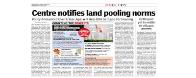
Ministry of Urban Development vide Notification dated 05.09.2013 modified the Master Plan 2021 to include the new Land Pooling Policy as Chapter 19 of MPD 2021. The new land policy is based on the concept of Land Pooling wherein the land parcels owned by individuals or group of owners are legally consolidated by transfer of ownership rights to the designated Land Pooling Agency for undertaking of development for such areas. Under the policy transfer of development rights is also allowed. It is expected to yield land to accommodate 10 million people and facilitate 
creation of 1.6 million dwelling units.

A part of land (48-60%) shall be transferred back to the owners (in two different modes). The policy is applicable in the proposed urbanisable areas of the Urban Extensions for which Zonal Plans have been approved.

Guiding Principles
Govt. / DDA to act as a facilitator with minimum intervention to facilitate and speed up integrated planned development. A land owner, or a group of land owners (who have grouped together of their own volition/will for this purpose) or a developer, referred as the "Developer Entity" (DE), shall be permitted to pool land for unified planning, servicing and subdivision / share of the land for development as per prescribed norms and guidelines. Each landowner to get an equitable return irrespective of land uses assigned to their land in the Zonal Development Plan (ZDP) with minimum displacement.

Role of DDA/Government
• DDA shall ensure the speedy development of Master Plan Roads and other essential Physical & Social Infrastructure and Recreational areas.
• It shall ensure inclusive development by adequate provision of EWS and other housing as per Shelter Policy of the Master Plan.
• Declaration of areas under land pooling and preparation of Layout Plans and Sector Plans based on the availability of physical infrastructure
• Superimposition of revenue maps on the approved Zonal plans
• Time bound development of identified land with Master Plan roads, provision of physical infrastructure such as water supply, sewerage and drainage, provision of social infrastructure and traffic and transportation infrastructure including metro corridors
• DDA shall be responsible for external development in a time bound manner
• Acquisition of left out land pockets in a time bound manner shall only be taken up wherever the persons are not coming forward to participate in development through land pooling Role of the Developer Entity (DE)
• Preparation of the layout plans/detailed plans as per the provisions of Master Plan and the policy.
• Demarcation of roads as per Layout Plan and Sector Plan within the assembled area and seek approval of layout plans/ detailed plans from the DDA
• Develop sector roads/internal roads/ infrastructure/services (including water supply lines, power supply, rain water harvesting, STP, WTP etc. falling in its share of the land.
• DE shall be allowed creation of infrastructure facilities, roads, parks etc. at city level subject to approval of Competent Authority
• Return of the prescribed built up space/ Dwelling Units for EWS/LIG Housing component to the DDA as per the policy.
• Timely completion of development and its maintenance with the entire neighborhood level facilities i.e. open spaces, roads and services till the area is handed over to the Municipal Corporation concerned for maintenance.

Land pooling Policy shall also support, for promoting mass housing construction technologies. Improved construction technology and methodologies, which may help, execute housing projects more efficiently and in lesser time. Construction techniques such as prefabricated and modular construction, and innovative construction materials can further help execute projects in lesser time and with reduced resources. More impetus however, would have to be provided to promote the use of these initiatives.

Some suggestions being looked into in this direction are:
• Offer subsidies and waive off import duty on special construction equipments, technologies, and materials.
• Provide incentives such as waive off excise duty, value added tax, etc. on pre-fabricated construction elements.
• Promote active R and D in this for the development and marketing of newer, more effective technologies, materials, etc. domestically The usage of such technology could help in fastening the delivery of housing stock and meeting the housing for all vision.

Rest of the development to be undertaken by the DDA. Land pooling is extensively used globally. It was first adopted by Holland and Germany in and around 1890s. The policy quickly spread across the globe. India has also successfully implemented the land pooling in the past and let us hope that this time too the L- Zone with its land pooling policy shall be a huge success.

Friday, August 7, 2015

Land Assembly Techniques

There are various techniques through which Land for development can be assembled; although land acquisition and purchase are simple and straight methods but in between these two, there are several other models of land assembly, which are being used in different States.

The UDPFI (Urban development plans formulation and implementation) guidelines classify these as: Land pooling and distribution schemes, popularly known as town planning schemes. Let us take a look at how in past in other states the same has been done.

Town Planning Schemes – the Gujarat experience 
The basic concept of Town Planning Schemes is pooling together all the land under different ownerships and redistributing it in a properly reconstituted form after deducting the land required for open spaces, social infrastructures, services, housing for the economically weaker section, and road network. This process enables the local authority to develop land without fully acquiring it and gives it a positive control over the design and the timing of the urban growth. This method is extensively practiced in Gujarat and Maharashtra, selectively in Kerala and occasionally in Andhra Pradesh and Tamil Nadu. To achieve the ultimate objectives of the Development Plan, Town Planning Schemes are prepared for smaller areas of about 100 hectares. Implemented under the Maharashtra Region and Town Planning Act, 1966 in Maharashtra and under the Gujarat Town Planning and Urban Development Act, 1976 in Gujarat. Since the reconstituted plot has better accessibility and good potential for development, its value gets enhanced. Part of such increment in land value is contributed for the cost of development work in the scheme. The landowners get the net amount of increment value of the plot worked out after deducting the amount of compensation payable for the loss in area. 

Haryana Model 
Haryana experimented with a new model of land assembly under the Haryana Development and Regulation of Urban Areas (HDRUA) 1975 permitting, under grant of license from the DTP, private developers to assemble lands from the market through negotiations and develop these to build residential colonies. Private developers are allowed to negotiate on market price with agricultural and other landowners to buy land. Private colonizers prepare layout plans for integrated development of residential areas, with their internal infrastructure considering the space norms specified in the city’s development plan. A developer is required to reserve 20% of housing for EWS and LIG, another 25% can be sold in the market on “No Profit No Loss” basis, while the rest 55% can be sold freely in the open market. The developer is required to pay to the HUDA, in proportion of its development costs for a colony, “External Development charges” (EDC) for getting connected to the HUDA’s trunk lines of utilities and “Infrastructure Development Charge” or IDC for citywide infrastructure development. The DTP is the nodal agency for regulating the functions and activities of the licensed private developers including checking their income and expenditure.

Ghaziabad Model 
GDA Model has been implemented for developing land and constructing houses under Urban Planning and Development Act, 1973. Basic reason is to make funds available for infrastructure development. It is envisaged as a joint venture between Ghaziabad Development Authority and private developer. The equity sharing between the GDA and the private developer is in the ratio of 10:90. This reduces the cost burden on the Authority. The compensation package streamlines implementation by reducing the 
litigations and constraints of the traditional land acquisition process. The private developers earn revenue from sale of 60% of plots in free 
market. The model is attractive for the Development Authority as apart from the 
less investment, and free of cost facilities, it earns annual revenue of 1% 
from the private developer (tie up cost index).

Noida Model
Farmers/ landowners are given certain compensation. Compensation rates are determined irrespective of location. These Compensation rates are revised after every financial year by linking them to “consumer price index”. A separate rehabilitation package in the form of additional 15% on basic land acquisition rate along with land compensation @ 1/5 of actual plot value. Development levies are charged from villagers.

Relevance of the Models to Delhi In view of the fast pace of development that Delhi needs in order to cater to the rapidly increasing population, a model of land development is required that is replicable and applicable on a large scale of 1000 hectares and above. Also, the model should not be confined to the residential pockets only. In the case studies (excluding the Noida model), scale is limited up to 100 or 80 hectares and that too within the residential pockets. The viability of replicating and up-scaling these models were assessed. The Haryana and Ghaziabad models provide for a reservation of 20% of plots for EWS/LIG. However, it needs to be considered whether this quantum of provision in Delhi’s context would be sufficient. It was to be seen whether the linking of compensation rates to the consumer price index as in the case of Noida, can be worked out in Delhi. Be it the TP schemes, or the Haryana and Ghaziabad models, the provision of infrastructure is limited to the layout level and does not take into account the Master Plan/Zonal Level facilities.

AMDA (Association of Urban Management and Development Authorities) Model for Delhi

AMDA proposed a “land pooling cum barter model” for development within the planned project areas in Delhi, the main features of which are: To ensure rational and attractive returns to the farmers. This can be achieved by returning net residential developed land upto 16% land under notification of section 4 surrendered to DDA by the landowner. This leaves upto 84% of land with DDA to meet the plan requirements. DDA gets 100% of the land for an area earmarked for development in lieu of the net 
residential land upto 16% returned to the landowner within a developed area. 16% of the land given for barter is based on the plan prepared and executed by the 
DDA and the conditions mentioned in the plan will be applicable. In the 84% of the land remaining, DDA develops all housing for EWS and part of the total DUs for LIG along with all the facilities at Master/Zonal plan level.

The landowner on the other hand has to provide all housing for HIG and MIG and a part of the total DUs for LIG in the land returned to him. Through this the model seeks to achieve the 
social equality of land. The landowner does not feel deprived of his land when he is given compensation in terms of land and he is also left with numerous options like: Retaining the land with him, to partially or totally dispose the land, waiting for land prices to rise in the market and selling to developers at market rates. Coming forward as a promoter,
 The barter system takes into account the entire spectrum of development, including the 
facilities to be provided at Master Plan/Zonal Plan/Layout level. 


AMDA also advised change in the institutional setup of DDA. The existing institutional mechanism under the DDA dealing with acquisition/development and disposal of land is highly centralized and has not been kept pace with provisions of Master Plan. Therefore, the following changes were suggested: Decentralize land assembly, development and disposal. Establish an autonomous body to monitor and regulate land acquisition/development 
and disposal under DDA Act.

Towards a New Land Pooling Policy(LPP) for Delhi

Since future land availability potential to accommodate the needs of future lies in urban extension areas, planned development of these areas was deemed essential. A study on evaluation of different models of land pooling in Delhi was commissioned by DDA. NCAER (National Council of Applied Economic Research) studied 3 alternate models of land pooling including financial evaluation based on data from 11 recently developed DDA projects and information from leading private developers in and around Delhi. Since infrastructure development also requires resources, PPP model was suggested in order that public authorities are able to recover external development charges (EDC) so that all essential services can be extended to the proposed urban extension areas.

The new land pooling policy was notified as alternative to land acquisition, with active involvement of the private sector. It has been incorporated as Chapter 19 of the Master Plan Review. Shall cover more details about the LPP and master plan in next post.